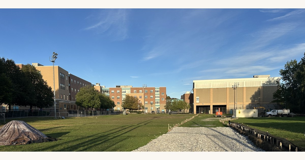
On Monday, October 5, two of us spent the last good light of the day at the Malden River Works, a day after the park's first phase opened. We arrived around 5:20 PM and left around 6:00. The first photograph was taken at 5:21 and the last at 5:52.1 Sunset was about 6:18 that evening,2 so the visit sat squarely in the hour before sundown, the stretch photographers call the golden hour.
It was breezy, blue-skied, and about 60 degrees. There was no free food, no promotion, no tents, and no speeches. In all that time we saw exactly two other people: bird watchers with cameras in working mode. For most of the visit we had the place to ourselves, and we used it the way the park invites you to: watching the trees bend in the wind while the sun gave its last rays of the day.
What follows is a walk through the park in the order we took the pictures. The light is lovely. It is also honest, and a quiet park makes a few questions easier to ask.
Where Is the Park?
The Malden River Works is on the Malden River at the Department of Public Works site, 356 Commercial Street, Malden.3 Our map marks where each of the 30 photographs in this piece was taken, in the order we walked, and every "View on map" link below jumps to that spot.
5:21 PM: The Salt Question
We started at the edge of the parcel, where what appears to be the current salt storage sits under a tarp behind a wall of heavy stone blocks. It is hard to miss, and it is worth asking whether it is needed where it is. As far as we could tell, it sits about as far from the river as is practical on the Department of Public Works parcel, and we saw no sign of a serious threat of runoff toward the water.
That is an observation from a walk, not an engineering finding. It does raise a plain question for the City: what is the long-term plan for salt storage on this parcel, and why? View on map →


A City of Malden Public Works truck sits just beyond the stone wall. The working side of the parcel and the park side are separated by a few feet and a row of blocks, which is the point of the salt question.


5:25 PM: The Stone Stairs
Then we took the stairs. They are broad, irregular slabs of stone set into the slope and edged with boulders, running down toward the river and the dock railings beyond. They are handsome, and in the low light they are also hard to read: the long shadows across the stone made it difficult to tell where one slab ended and the next began.
The treads are of very non-standard sizes, and you can see it in the pictures: some slabs run deep, some shallow, and the edges sit at different heights. We saw no handrail on either side. The boulders along the edge are decoration, not something to hold. Walking them a second time in two days, the missing railing was more noticeable than it had been the first time. View on map →


The City's project notice describes an accessible pathway along a restored riverbank to a new floating dock.4 These stairs are a different feature. So the question is not only whether they need a railing, but how many people will use them in place of the accessible route, in daylight, in the dark, and in wet or icy weather.
5:28 PM: Sun, Stone, and Wind
The cut stone throughout the park offers many places to sit, or lie down. The sun was low enough to throw long shadows across the lawn and to flare through the young trees, and the wind kept the whole planting in motion. View on map →


5:34 PM: The Docks
Then the water. The docks are a long floating walkway of pale decking running along the river, with a yellow stripe along the river edge, which is a sensible touch. On the shore side there is a railing with steel mesh. On the river side, in the stretches we photographed, there is the yellow stripe and then open water.
Aluminum struts angle from the shore down to the dock. Where they meet the floating section, the structure opens into a frame with the river visible straight through it, right beside the decking. The decking itself was littered with goose droppings, which make the surface slippery.
We did not see a physical barrier closing off the dock from the park. The only gate we found stands across the far northerly end of the dock, past the long open run of decking. It is a small double gate, and it is certainly not the safety envelope that would comfort us on a daily basis. View on map →


A public park is entitled to be a place where anyone, including a child, a dog, or an adult chasing a hat in the wind, can walk onto a dock. That is the case for good design and clear rules. We saw neither a posted set of dock rules nor life rings or other rescue gear anywhere along it.
5:36 PM: The Water
Beyond the dock, the stretch of the Malden River looked wide, calm, and a little rippled in the wind. Fall color was starting along the banks, and an American flag stood against a stand of changing trees with the Medford Street bridge behind it.


On the fence at the dock area, a green sign declares a "Public Passage" for fishing, fowling, navigation, and strolling, and cites M.G.L. Chapter 91 and a license number, WW01-0000278.5 On a tree nearby, a placard lists only a file number: 210-0100. View on map →


5:44 PM: What the Light Shows
The same low light that flatters a park also throws its edges into relief. Walking it a second time in two days, the things we noticed were practical ones. View on map →


- The ramps. The ramps to the dock are smooth, and they pose practical safety hazards. What happens when the weather turns them slippery?
- The water's edge. We saw only one small gate, across the far northerly end of the dock. Everywhere else, access to the water was free and unhindered.
- The stairs. The stone stairs have treads of very non-standard sizes and no handrail. They seem to call for a railing.
- The dock. We saw no visible safeguards: no robust posted rules, no life rings, no rescue gear, and a deck fouled with goose droppings.
- The bank. A large, sprawling, broken tree is visible at the river's edge and will have to be removed.
The same light that makes a park beautiful makes its hazards easy to see.
In our view, when a government entity actively encourages the public to use a new amenity, it also takes on the job of managing the hazards that come with it. Visible hazards left unmitigated carry legal, financial, operational, reputational, and safety risks, and the City is better off answering these questions before an incident than after one.
5:51 PM: Last Frames


The last picture for the evening is a red sign behind the fence that reads "Caution Makes Frequent Stops." We do not know what it was written for. But on a visit spent noticing what was missing, the gates, the railings, the life rings, it was hard to argue with. View on map →
Questions We Would Put to the City
- Were the dock decking, ramps, and struts evaluated for slip resistance when wet, icy, or fouled by goose droppings, and who is responsible for keeping them clean?
- Is access to the dock and water's edge meant to be unrestricted, and what safeguards, such as gates, posted rules, or hours, are planned beyond the one small gate at the far end of the dock?
- Have the stone stairs been reviewed against railing and tread-dimension requirements, and are they part of an accessible route or an alternative to one?
- Will life rings or other rescue equipment be installed at the dock, and who is responsible for maintaining them?
- What is the timeline and responsible party for removing the broken tree on the river bank?
- What is the long-term plan for salt storage on the DPW parcel, and does it have any bearing on the park?
- What do the Chapter 91 license (WW01-0000278) and the file number 210-0100 require of the City regarding public access and safety?